- Thumbnail
- Resource ID
- 81b14672-7b17-11e9-a095-080027c1726a
- Title
- forest_ecosytem
- Date
- May 20, 2019, 10:54 a.m., Publication
- Abstract
- No abstract provided.
- Edition
- --
- Owner
- tarikugeda
- Point of Contact
- Ayane
- tarikugeda@gmail.com
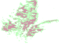
- Purpose
- This spatial data was adopted from the Potential Natural Vegetation (PNV) map of Ethiopia. For more information visist: http://vegetationmap4africa.org/
- Maintenance Frequency
- None
- Type
- not filled
- Restrictions
- otherRestrictions
- License
- Not Specified
- Language
- eng
- Temporal Extent
- Start
- --
- End
- --
- Supplemental Information
- The original data set was developed in the year 2012
- Data Quality
- This data quality
- Extent
-
- long min: 34.139998634719200
- long max: 43.194164938549500
- lat min: 3.714166518143740
- lat max: 14.553332751613300
- Spatial Reference System Identifier
- EPSG:4326
- Keywords
- no keywords
- Category
- Biota
- Regions
-
Global
,
Africa
,
Central Africa
,
East Africa
,
Djibouti
,
Eritrea
,
Ethiopia
,
Documentliist
,
Kenya
,
Somalia
,
Uganda
,
North Africa
,
Sudan
,
South Sudan
,
Asia
,
East Asia
,
South Asia
,
Middle East
,
Yemen
,
Pacific
,
Kiribati